
Diwata-2 maintains a watchful eye as the country braces for Typhoon Tisoy (Kammuri). The satellite’s Wide Field Camera (WFC) captured an image of the storm as it approached Bicol region at 12:58:47 PHT on December 2, 2019.
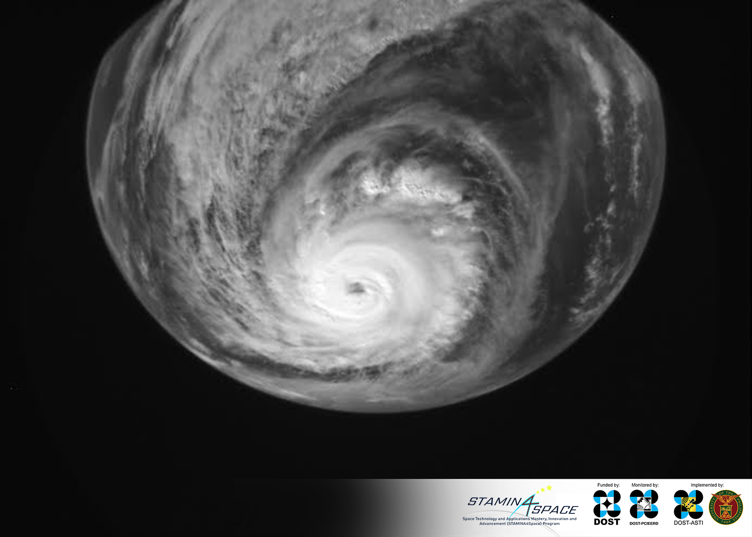
Typhoon Tisoy as seen from space. The image was taken using Diwata-2’s Wide Field Camera (WFC).
At the time of capture, the storm clocked maximum sustained winds of 150 kph and gustiness of up to 185 kph according to Philippine Atmospheric, Geophysical and Astronomical Services Administration’s (PAGASA) severe weather bulletin issued at 2:00 pm on December 2. Seen in this image is the eye of the typhoon, which is roughly 200 km away from Gubat, Sorsogon where the typhoon made landfall at around 11 pm on the same day.
Latest bulletin from PAGASA as of 11 am this morning shows the center of the typhoon at 55 km east of Calapan City, Oriental Mindoro with maximum sustained winds of 150 kph near its center and gustiness of up to 205 kph.
As an Earth-observing microsatellite, Diwata-2 is equipped with cameras such as the WFC which can be used to capture images of cloud patterns and typhoons. It will continue to monitor Tisoy as it moves across Luzon and leave the Philippine Area of Responsibility (PAR). Forecast from PAGASA shows that Typhoon Tisoy will be out of PAR around morning of Thursday, December 5.
Please heed instructions for evacuation and observe safety precautions. Keep safe, everyone!
References:
PAGASA Severe Weather Bulletin №11. http://pubfiles.pagasa.dost.gov.ph/tamss/weather/bulletin/SWB%2311.pdf
PAGASA Severe Weather Bulletin №18.
http://bagong.pagasa.dost.gov.ph/tropical-cyclone/severe-weather-bulletin/2
Learn more about Diwata-2 or browse, download, or request for Diwata-2 images.