
Diwata-2 sent back more images before 2018 came to a close, this time showcasing acquisitions made by the microsatellite’s Enhanced Resolution Camera (ERC) and Middle Field Camera (MFC).
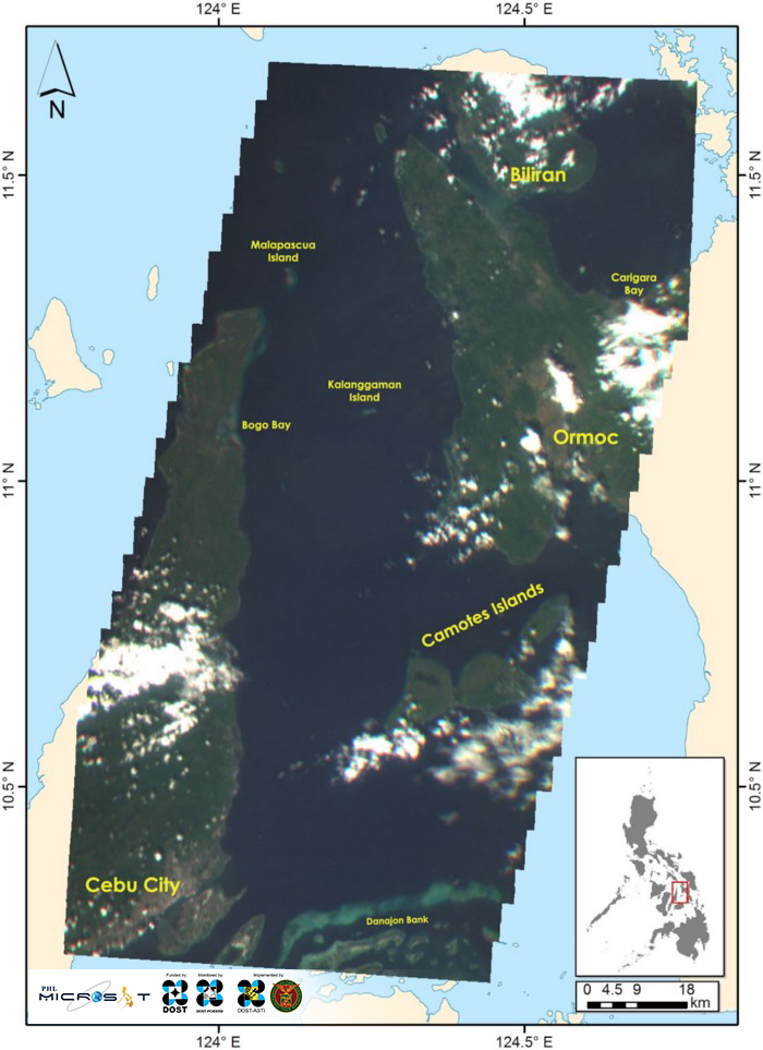
The image above is a mosaic of 20 images showing several areas of the Philippines’ Visayan Islands. The images were captured by Diwata-2’s Spaceborne Multispectral Imager (SMI) payload, with the ERC used to pansharpen the images in the figure below. In the image above, we can see parts of Cebu City, Biliran and Ormoc — including some of Ormoc’s sugarcane fields, which appear as brown patches. Popular tourist attractions such as the Camotes Islands, Kalanggaman Island and Malapascua Island are also visible. Also worth noting is the prominent Danajon Bank area, which is the only double-barrier reef in the Philippines. It is valued as a unique coastal environment which serves as an important conservation site for mangroves, corals and marine life.¹
These neighboring areas are located within and around the Camotes Sea and Visayan Sea, the latter being one of the Philippines’ largest fishing grounds. In the 10th Visayan Sea Summit held in Iloilo on September 28, 2018, representatives from Iloilo, Negros, Capiz, Masbate, and Negros Occidental signed a framework that better protects and conserves the sea’s biodiverse ecosystem.² With Diwata-2’s revisiting capability, high priority areas such as the Visayan Sea and its surrounding areas may be regularly monitored.
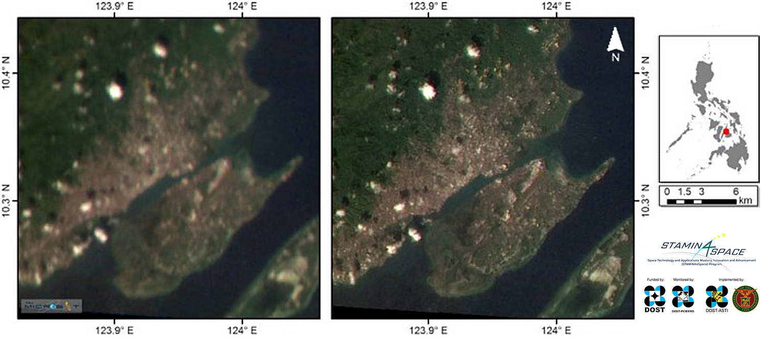
Pansharpened using ERC. This image highlights the contrast between an SMI image pansharpened with ERC (right) versus an SMI image with no pansharpening applied (left).
Displayed above is a side-by-side comparison of a portion of the mosaic previously shown, with one enhanced or pansharpened by the ERC image (right), and the other with no pansharpening applied (left). The ERC is a panchromatic camera used to increase the resolution of the images captured by the SMI, with a field of view of 89.67 km and a spatial resolution of 54 m.
Pansharpening is a technique where a high-resolution panchromatic image is fused with medium-resolution multispectral image to create a multispectral image with higher-resolution features.³ We can observe that the pansharpened image contains more details of the urban area captured. Pansharpening is therefore vital in resolving more details and features from the image, providing us with more data about the location captured.
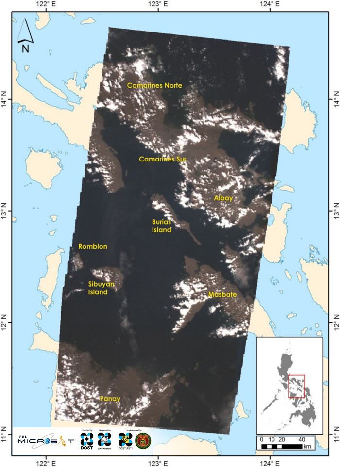
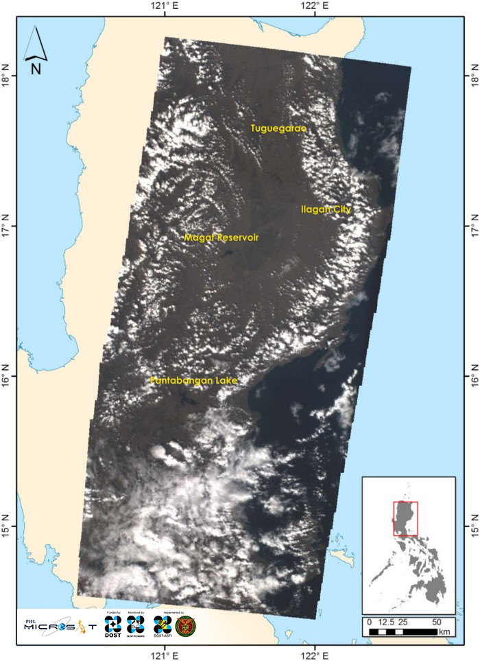
Aside from the SMI and ERC, Diwata-2’s Middle Field Camera (MFC) also yielded an image stretching from Camarines Norte down to a part of Panay Island on December 25, 2018, as well as parts of North Luzon starting from the National Capital Region (obscured by clouds) up to Tuguegarao on December 26th. The MFC is a camera used to help locate the images captured by the High Precision Telescope (HPT) and SMI on the map. It is important in helping determine which part of the world is shown in the images captured.
Previously, the first images captured and featured were those taken by the SMI, HPT, and Wide Field Camera (WFC) payloads. This second set of Diwata-2 images is part of the ongoing calibration and validation phase of these optical payloads. Testing of more instruments in the microsatellite are underway, including the voice communications testing of the amateur radio unit (ARU). Initial successes have been achieved by the team and several collaborators in separate voice repeater tests in Quezon City, Philippines and San Diego, California, USA. Additional testing is currently underway for more functionality verification and consistency checks.
References
¹ Samonte, Giselle P.B., et al. “Economic Value of a Large Marine Ecosystem: Danajon Double Barrier Reef, Philippines”. Ocean and Coastal Management, vol. 122, 2016, pp.9–19. Elsevier, coast.ph/sites/default/files/Samonte%20et%20al%202016_Danajon%20Econ%20Valuation.pdf
² Retrieved from https://www.sunstar.com.ph/article/1766982
³ Retrieved from https://landsat.usgs.gov/what-pan-sharpening-and-how-can-i-create-pan-sharpened-image
Learn more about Diwata-2 or browse, download, or request for Diwata-2 images.