
Today, 15 June 2017, is the twenty-sixth anniversary of the eruption of Mount Pinatubo. Considered the second largest eruption of the 20th century and the largest eruption to affect a densely populated area¹, the effects of the cataclysmic event are still visible today.
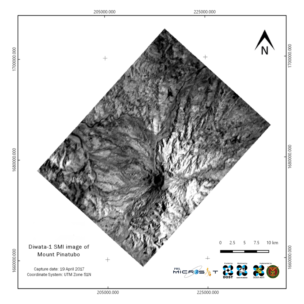
To commemorate this historic natural event, the PHL-Microsat Program presents this near-infrared image of Mount Pinatubo as taken by Diwata-1’s spaceborne multispectral imager (SMI) sensor. This image was taken last 19 April 2017 at around 8:30 A.M. Philippine Standard Time.
Diwata-1 SMI image captured on April 9, 2017.
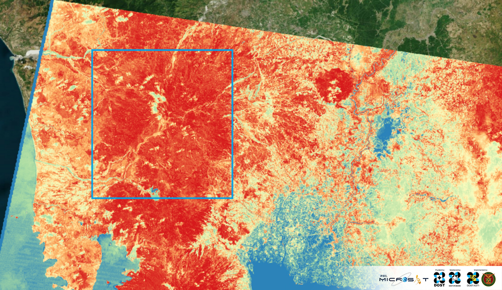
On July 1990, a year before the devastating eruption of Mt. Pinatubo, the Landsat 5 satellite of the United States was able to capture images of the volcano. From those images, a normalized difference vegetation index (NDVI) image was created. The NDVI shows levels of plant health and photosynthetic activity via a color gradient. In the image below, areas in red show photosynthetic activity or the presence of plants. The more intense the red color of the area, the healthier the vegetation. Areas in blue show regions of low or no photosynthetic activity. We can clearly see that the area around the volcano (boxed in blue) was densely vegetated before the eruption.
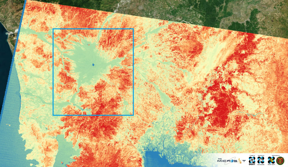
Compare this with the image below, an NDVI image of the same region derived from Landsat 5 images taken on January 1992, around six months after the eruption.
Landsat 5 NDVI image of Mt. Pinatubo before the eruption, July 1992
The effect of the eruption on the flora around Mt. Pinatubo and beyond is very evident. What used to be dense reddish regions of healthy vegetation have become bluish areas of little to no photosynthetic activity. The crater lake formed as a result of the eruption is also now apparent as a dark blue patch (center of the blue box).
Fast forward to the present, our very own Diwata-1 took images of Mt. Pinatubo using its SMI sensor. The derived NDVI image below reveals signs of recovery around the scars of lahar flow. Reddish patches show that local flora now flourish around these scars, slowly erasing the marks of devastation.
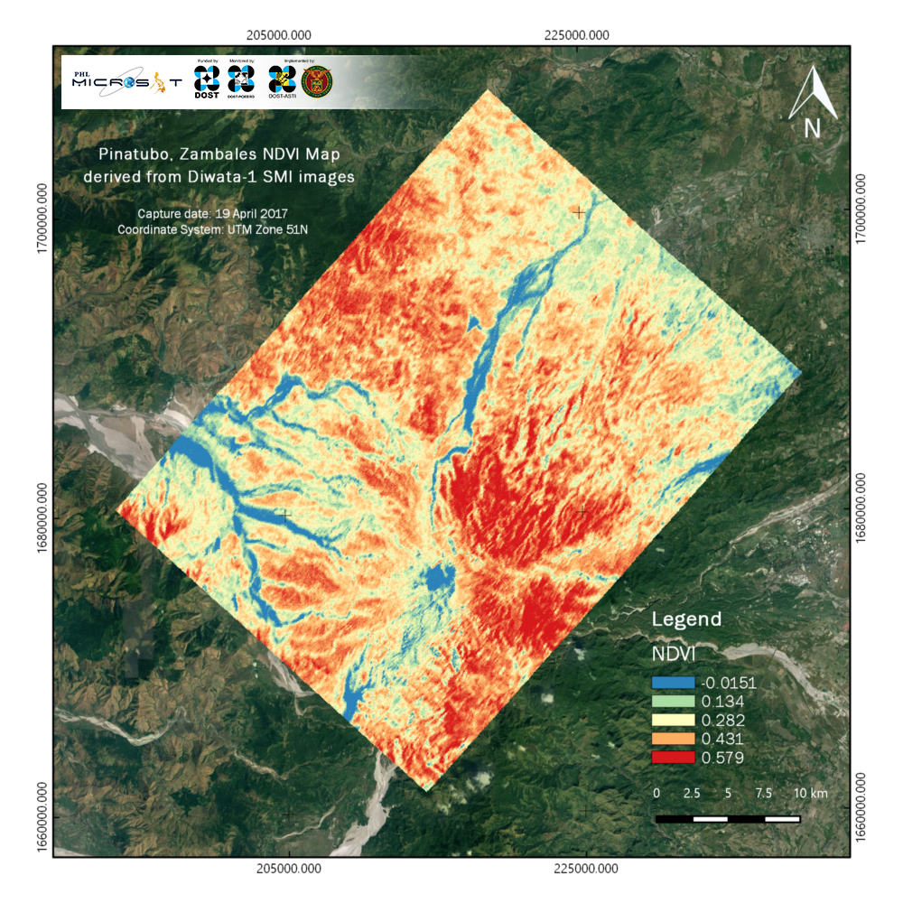
NDVI map derived from Diwata-1 SMI image
References
¹ https://pubs.usgs.gov/fs/1997/fs113-97/
Read more about Diwata-1 or browse, download, or request for Diwata-1 images.